JORDAN: Aquaba (BMNH
2258, 2).
ISRAEL : Elat (AMNH
125441, 2; AMNH 92656, 2). Elat, Angelica Beach (DLG AAB 09e, 1).
Elat, Coral Beach (DLG AAB 09d, 1). Gulf of Fara'um [= Faraun ?],
Gulf of Elat (USNM 769972, 1: complete; USNM 769990, 2: complete).
Gulf of Elat (AMNH 221666, 2; AMNH 220214, 2).
EGYPT : Sinai,
Dahab, Oasis (DLG 09a, 3; SMF 311910/4, 3). Sinai, Dahab (SMF 311911/3,
3; SMF 311909/1, 1). Sinai, Dahab, Mangrove of Nabq (SMF 311908/1,
1). Sinai, Devilshead (DLG AAB 09c, 3). Sinai, Na'ama Nasra aal Et
(DMNH 073898, 4). Sinai, Na'ama, Masra al Et (AMNH 174080, 5). Sinai,
Sharm el Sheik, Ras um Sid (DLG AAB 09p, 4). Sinai, Sharm el-Sheik,
Ras Mohammed, profile 3 (SMF 311907/1, 1: complete). Sinai, N of Nuweiba
(MHNG uncataloged, 4). S Tiran (DLG AAB 09q, 1). Ras Benas (USNM 604098,
1). NW Gulf of Suez, Wadi el Dom (LACM 67-86, 6). 21 km N of Quseir
(LACM 67-88, 4). Al-Ghardaqa (=Hurghada) (LACM 8980-68, 1: complete;
BMSM 2051, 1). Hurghagda, Biological
Station (EN no #, 1). Umm el (= al) Kiman (AMNH 179941, 1).
SAUDIA ARABIA: Near
Yanbu (BMNH 2363, 1). Jedda (DMNH 121107, 5; DMNH 051062, 4). N of
Jedda (AMNH 151133; AMNH 148961, 1). Jedda, 14 km N of (DMNH 120252,
9). Shuaiba [?], 60 mls S. of Jiddah (EG 3414,
1). Abu Latt Isl. (MNHN no #, 1). Aden (BMNH no #, 1). Dahab,
Gulf of Aqaba, Sinai (AMS C.402400, 1). Sinai, Gulf of Aqaba, Nuweiba
(AMS C.141966, 4). Sinai, Gulf of Aqaba, Nuweiba (AMS C.402396, 3).
Sinai, Gulf of Aqaba, Nuweiba (AMS C.402397, 4). Sinai, Gulf of Aqaba,
Nuweiba (AMS C.402398, 1). Sinai, Gulf of Aqaba, Nuweiba (AMS C.402399,
5). Sinai, Gulf of Aqaba, Nuweiba (AMS C.402401, 2).
SUDAN
: Port Sudan (AMNH 220221, 1; DMMF IIE-8218, 3: 2 complete). Port
Sudan Harbor (BMNH 2341, 1). S of Port Sudan (UR 272, 1). 16 km S
of Port Sudan, N Towartit complex, Harvey Reef (BMNH 2341, 3). Sanganeb
Atoll, S anchorage (SMF 311906/2, 2: complete). Sanganeb Atoll, N
anchorage (SMF 311905/3, 2: complete). 20 km off Muhammed Qol, Shaab
Baraia (BMNH 2341, 4; BMNH 2341, 4).
DJIBOUTI: Djibouti
(MNHN no #, 3).
YEMEN: Socotra
Isl., Hadibo (UR no #, 3).
OMAN : Humer (BMNH
Smythe collection, 1). Qurm near Muscat (BMNH Smythe collection, 1).
Muscat (AMNH 127234, 1).
KENYA : Malindi,
Gedi, Watamu Beach (AMNH 220209, 1). Malindi (USNM 595039, 1). Shimoni
(DLG AAB 09j, 4). Shimoni, Wasin Village (BMNH 2241, 1). Mtwapa (NMBE
ex 1507.955, 1). Mombassa (BMNH no #, 1; BMNH no #, 2). Faubourg de
Mombasa (MNHN no #, 3). Near Mombassa (AMNH 220222, 2; AMNH Edison
A9853, 2). Mombassa (AMS C.140726, 6). Takaunga,
ca 30mls N of Mombassa (AMS C.088124, 1). Vipingo, N of Mombassa (AMS
C.404647, 0, 1: complete).
TANZANIA : Zanzibar,
Kiwenga (DMNH 045981, 4; ANSP 212431, 69). Zanzibar, Je, Boamo, 5
miles S of Paje (ANSP 213154, 16). Zanzibar, Ras Nungwe (ANSP 212799,
23). Zanzibar, Mangapwani (ANSP 212982, 1). Zanzibar, Kizimakazi (ANSP
214118, 4). Zanzibar, Fumba (DMNH 045982, 1). Zanzibar, Kiwengwa (USNM
597238, 1). Zanzibar, Uzoi (AMNH 220218, 5). Zanzibar, Chango (BMNH
1811, 1). S of Mafia Isl. (LACM 45869, 2). Dar es Salam (LACM 45848,
1; DMNH 110695, 10). Dar es Salam, Sinda Isl. (USNM 704049, 2). Dar
es Salam, Ras Kankadya (USNM 704020, 2). Oyster
Bay, 3km. N of Dar es Salaam (AMS C.404646, 0, 2: complete).
MOZAMBIQUE : Pemba
(DLG AAB 09w, 5). Puerto Amelia (LACM 45853, 3; LACM 111045, 4). Inhaca
Isl., Maputo (DLG AAB 09v, 10). Bazaruta Isl. (DMNH 011048, 2). Nacala
Bay, Ferno Veloso (NMBE 1505.107, 1; NHBE ex 1507.89, 4). Mozambique
Port (AMNH 80450, 3). Mozambique City (AMNH 114807, 6; ANSP 234109,
1). Porto Amelia (AMS C.121615, 20). Ilha Quilaluia
(AMS C.384727, 1).
SEYCHELLES : (BMNH
no #, 1). Comoros: Grande Comore, Mitsamiouli (LACM 45935, 4). Mayotte
(BMNH no #, 1).
MADAGASCAR : Nosy
Be (AMNH 220220, 2). Nosy B, Andilana (DMNH 045923, 2). Nosy Be,
Ambka (AMNH Edison A9853, 2). W Nossi Be, N shore of Nosy Saktia (ANSP
257888, 5). W Nossi Be, Nosy N'Tangam (ANSP 258698, 14). NW Nosy Be,
at Andilanda (LACM 89-53, 6: 3 with dried bodies). 13û 31' S 48û 32'
E (USNM 719376, 1). Tulear (LACM 144277, 2; MNHN no #, 1). Tulear,
Infati (SBMNH no #, 2; DLG AAB 09u, 2). N Tulear, Mora Mora (LACM
144355, 1; LACM 89-50, 1: complete). Anakao (DLG AAB 09s, 3). Between
Fort Dauphin and Monantenina (DLG AAB 09y, 13). Androka (MNHN no #,
1). Beheloka, S of Tulear, headland on S side
of bay (AMS C.402395, 2).
MASCARENE ISLANDS: Cargados Ids (AMS
C.035931, 1).
REUNION : (LACM
A.2777, 3; BMNH 1829, 2). Cap Homard (DMNH 179566, 4). 2 km S of St.
Leu (LACM 89-60, 2: complete). St. Giller (DLG AAB 09k, 2).
MAURITIUS : (LACM
S.1051, 2; LACM 22227, 1). 0.25 miles N of Black River Bay (DMNH 045913,
7). 1 miles W of Black River (ANSP 273941, 1). S side Tombeau Bay
(ANSP 272160, 1). Port Louis (USNM 149075, 1).
LITERTURE, LOCALITIES:
Madagascar, Ampalaza, Nosy Manitsa; Foulpointe; Tamatave (Dautzenberg,
1929). S of Aqaba (Mergner, 1979). Akhziv, Shiqmona (Talmadge, 1971;
Fainzilber, 1984; Barash & Danin, 1992). RSA, N Kwa Zulu, Kosi Bay
(Muller, 1984). Lybia, Tobruk (Gianuzzi-Savelli et al., 1994).
LITERATURE, RANGE:
Mozambique; Madagascar; Zanzibar; Kenya; Red Sea; Ceylon - S India;
Mauritius (Talmadge, 1956). Persian Gulf; E Africa; Somaliland; Red
Sea (Talmadge, 1974). Red Sea (Sharabati, 1984: as varia). Gulf of
Suez, NW Indian Ocean (Abbott & Dance, 1983: as ancile). Gulf of Suez
and Elat; Red Sea; Madagascar; Seychelles; Mauritius (Barash & Danin,
1992).
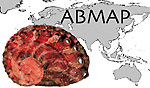 ABMAP
ABMAP