NSW: Sydney, Long
Reef (LACM H-338a, 1).
VIC: Flinder's
Isl. (LACM 28835, 2). Philip Isl., Westernport Bay, Sandy Point (LACM
79-50, 1). Philip Isl., Cat Bay (SBMNH 204, 3). Western Port (ANSP
132937, 1). Merricks, Western Port (AMS C.404511,
0, 1: complete). Portsea, Port Phillip (AMS C.404239, 0, 2: complete).
AS
EMMAE: Flinders (AMS C.404520, 0,
7: complete). Phillip Is, Westernport (AMS C.104222, 1). Port Fairy
(AMS C.002719, 1). Port Fairy, South Reef (AMS C.073558, 4). Port
Phillip Bay, Hampton (AMS C.401003, 8). Portsea, Port Phillip (AMS
C.092000, 23). The Pinnacle, 1ml off Cape Woolamai (AMS C.095926,
1). Western Port (AMS C.047517, 1). Western Port, Point Leo (AMS C.104221,
1).
TAS: (AMNH 182974,
2; = Van Diemens Land: NMBE Schuttleworth, 2). Blyth (LACM 45927,
1).
AS EMMAE:
Bass Strait, Clarke Is (AMS C.104223, 1). Bass Strait, King Island
(AMS C.048989, 1). Between Burnie & Stanley (AMS C.104219, 2). Black
River Beach, near Stanley (AMS C.104220, 3).
SA: Tumby Bay (AMNH
Edison A9853, 1; SBMNH 205, 1). Port Lincoln (SBMNH 224, 1; SBMNH
25216, 8). Point Lincoln (WAM S1007, 1: complete). Adelaide (LACM
45986, 1). Adelaide, Glenelg, Broadway Reef (LACM 91288, 1). Adelaide,
Glenelg, Kemps Ground (AMNH 252366, 1). Marino (MNHN no #, 4; MNHN
no #, 2). Pt Willunga (LACM 120215, 2; LACM H-794, 5). S of Adelaide,
near Rapid Bay, Second Bay (LACM 76-42). Spencer Gulf, Moonta Bay
(LACM 45954, 2; DMNH 008703, 2). Wallaroo (ANSP uncataloged, 2). Stansbury
(AMNH 220178, 1). Yorke Peninsula (AMNH 220176, 6). Normanville (AMNH
220175, 1; AMNH 220239, 2). Cape Jervis (AMNH 80426, 2). St. Vincent
Gulf (AMNH Edison A9853, 1). Kangaroo Isl., Hog Bay (LACM 22219, 1;
LACM S.1112, 2). Port McDonnell (AMNH 175334, 1). Aldinga
(AMS C.041846, 2). Aldinga, just N of (AMS C.404246, 0, 3: complete).
Edithburg (AMS C.404229, 0, 1: complete; BMSM
1971, 1). Kangaroo Is, Penneshaw (AMS C.404251, 0, 1: complete).
St Francis Is, Nuyts Archipelago (AMS C.404248, 0, 1: complete).
AS EMMAE:
Adelaide, Glenelg Beach (AMS C.401004, 2). Adelaide, Semaphore Beach
(AMS C.100172, 4; AMS C.401002, 2). Aldinga (AMS C.072570, 10; AMS
C.073552, 1). Cape Jervis (AMS C.117534, 1). Edithburg (AMS C.073559,
1). Guichen Bay (AMS C.041845, 2). Horseshoe Reef, Port Noarlunga
(AMS C.404529, 0, 1: complete). Knob Bluff, N coast Kangaroo Is (AMS
C.404202, 0, 2: complete). Normanville, S of Adelaide (AMS C.073554,
1). Port Augusta (AMS C.073556, 1). Port Lincoln (AMS C.404526, 0,
1: complete; AMS C.073555, 1; AMS C.401005, 1). Port Noarlunga (AMS
C.404524, 0, 1: complete). Port Willunga (AMS C.401006, 1). Robe (AMS
C.100214, 3). Rocky Point, Eastern Cove, Kangaroo Is (AMS C.077829,
4). Spencer Gulf, Wardang Is (AMS C.401007, 1). St. Vincents Gulf
(AMS C.004571, 1). Tiparra Reef, off Pt Hughes (AMS C.088729, 3).
WA: Geralton (LACM
45855, 1). Jurien Bay (AMNH Jackson 1992 A9873, 10). N of Perth, Marmion
(AMNH 272147, 2). Perth (LACM 45849, 1). Perth, 2 mile Beach off Sorrento,
off Limestone Reef (AMNH 220240, 2). Perth, Burns Beach (USNM 711213,
1). Quinn;'s
Rock (BMSM 3267, 2). Off Quinn's Rock [just north of Perth] (AMNH
137202, 1). Swan River (ANSP 50223, 2; BMNH 52.7.28.37-38,
2). Freemantle (DMNH 010200, 2; AMNH 199100, 2). Freemantle, Rottnest
Isl. (LACM 87-91, 4; AMNH 203252, 3). Perth, Cockburn Sound, Woodmans
Point (USNM 672361, 3). Binningup [just north
of Bunbury] (BMNH 2341, 1). Bunbury (AMNH 240638, 3; BMNH no
#, 7). Geography Bay (AMNH 252370, 1; BMSM 2074,
1; AMS
C.018031, 3). Cape Naturaliste (DMNH 011004,
2; USNM 691501, 2: complete). Cape Naturaliste, Eagle Bay (BMNH 2237,
2). Cape Naturaliste - Cape Leeuwin National Park, Gracetown, Cowaramup
Bay (LACM 45834, 1; LACM 95-56, 1: complete). Cape Naturaliste, Bunker
Bay (USNM 691540, 2: complete). S of Cape Clairault (LACM 95-53, 2).
Margaret River (LACM 45919, 7; LACM 45945, 11). Peaceful
Bay [near Walpole] (SBMNH 215, 2). Albany (SBMNH 36202, 1,
MHNG 21812, 1). Albany, Frenchman's Bay (DMNH 011007, 1; LACM 30387,
1). Albany, Freemantle Bay (LACM 29948, 1). 0.25-0.5
mls off Peppermint Grove Beach, between Bunbury & Busselton (AMS C.096213,
1; AMS C.101116, 2, 2: complete). 3.5km off Dunsborough (AMS C.404223,
0, 2: complete). Albany (AMS C.400998, 1; AMS C.400999, 1). Bunbury
(AMS C.038302, 1). Cape Naturaliste lighthouse, on N side (AMS C.404247,
0, 3: complete). Capel area, S of Bunbury, Naturaliste Reef (AMS C.404245,
0, 2: complete). Carnac Is, off Freemantle (AMS C.403151, 1; AMS C.403155,
1). Cowaramup Bay, S of Cape Naturaliste (AMS C.400995, 1). Dongara,
mouth of Irwin River (AMS C.003194, 1). Dunsborough (AMS C.067358,
2, 2: complete). Eagle Bay, W of Dunsborough (AMS C.174089, 1). Esperance
area (AMS C.073551, 1). Foul Bay (AMS C.056370, 4). Fremantle (AMS
C.080597, 1). Geraldton (AMS C.009080, 1). King George Sound, Mistaken
Rabbit Is (AMS C.048305, 3). Kwinana, Cockburn Sound (AMS C.400991,
7). Mississippi Bay, 30ml E of Esperance (AMS C.133545, 1). Moses
Rocks, S of Cape Naturaliste (AMS C.403152, 1). Off Forest Beach,
S of Bunbury (AMS C.072990, 3). Perth, Cottesloe Beach (AMS C.400996,
2; AMS C.403153, 1). Perth, Cottesloe Beach & nearby beaches (AMS
C.073553, 4). Port Gregory, N of Geraldton (AMS C.095714, 1). Recherche
Archipelago, Woody Is (AMS C.402331, 1). Rottnest Is (AMS C.400997,
1). Rottnest Is, Ricey Beach (AMS C.400994, 2). South Point, S side
of Two Peoples Bay, near Albany (AMS C.404240, 0, 1: complete). Vansittart
Bay (AMS C.045130, 1). Windy Harbour (AMS C.400992, 1). Yallingup
(AMS C.095829, 1, 2: complete; AMS C.403154, 2; AMS C.404205, 0, 6:
complete).
AS
EMMAE: Geographe Bay (AMS C.018033,
2). Recherche Archipelago, Woody Is (AMS C.401001, 1).
NT: Darwin (BMNH
Smythe collection, 1).
INDONESIA: Java
(AMNH 23110, 1).
LITERATURE, LOCALITIES:
Esperance; Ellenbrook; Edithburgh; St. Francis Isl.; Point Sinclair;
Kingston; Guichen Bay (Cotton & Godfrey, 1933). Corny Point; Gulf
of Vincente (Cotton, 1943). Port Willunga (Cotton, 1959). VIC, Sorrento
(Macpherson & Gabriel, 1962: as emmae). SA, West Isl. (Shepherd &
Godoy, 1989). WA, Marmion Marine Park (Wilson, 1993).
LITERATURE, RANGE:
Geraldton - central TAS (Shepherd, 1973). Jurien Bay - VIC and TAS
(Wells & Bryce, 1985). Geraldton - SA (Ludbrook & Gowlett-Holmes,
1989). Geraldton - W SA; VIC, TAS - W SA (Wilson, 1993: as emmae).
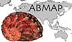 ABMAP
ABMAP