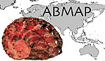
 ABMAP
ABMAP
The Abalone Mapping Project
Untraceable
localities:
I have indicated below all the localities that I could not locate on
any map, atlas, gazetter, or web site. The main ones I have consulted
include The Times Atlas of the World, Andrees Handatlas (8th edition,
1930), US Gazetteers, and the Getty Geographic Thesaurus, plus additional
more regional sources. If you can provide coordinates for any of these
localities, please do let me know. Thank you. This listing is a working
document, so it is not polished but simply raw information.
asinina
Hiramejima Isl. (ANSP 119680, 1).
Owaji, Japan (SDMNH 32739, 4).
Conchin, China (SDMNH 21374, 1).
Bungau, Sulu Archipelago, Philippine Islands (SDMNH 21353, 1).
Luson, Canimo Isl. (USNM 245510, 1)
Palawan, Dipalian Isl. (LACM 74709, 1).
Negros Oriental, Bonbonon (9 03N 123. 08E), Antolong Bay (USNM 802097,
1: complete).
Negros Oriental, Guihulhga (SBMNH 06172, 3).
Marongasi Isl. (USNM 245536, 2).
Tataan, Simaluc Isl. (USNM 245505, 2).
Similans, Similan Isl., (SBMNH 5609, 1).
Sibuan Isl. (USNM 657678, 4).
SW Sumatra, Isl. W. shore, Veeckens Bay, S. Pagi Isl. (USNM 654948,
1).
Molluccas, S end of Kajoa Isl. (USNM 746392, 1). listed in Andrees but
cannot locate!!!
Marovo Lagoon, Uipi Isl. (SBMNH 6130, 1).
:inlandHargraves (LACM 45823, 2). 32 47s 149 27e ???
Dent Isl. (USNM 835587, 1).
Branston Reef (SBMNH 25571, 2).
NE QLD, Beaver Reef (SBMNH 216, 1). a
Border Reef (SBMNH no#, 2).
Hawke's Nest Beach (MHNG 21163, 1).
Dingo Beach (23 40S 149 021E) (SBMNH no#, 2).
Austr.: Bushy Isl.
(BMSM 3253, 5).
Double Island, GBR (LACM UCLA, 4).
aurantium
off Espiroto Santo, Brazil, 20û37'5"S 39û59'0"W
(WAM, 2).
australis
Stewart Isl., Smokey Beach (SBMNH 6163, 1).
Stewart Isl., Ocean Beach (AMNH 86732, 3; ANSP 232270, 4).
Stewart Isl., Ringa Ringa (AMNH 220148, 1).
Harrold's Bay (AMNH 126328, 2).
Waisi's Point (AMNH 116025, 1).
Kemfis Beach (SBMNH no#, 1).
N. Isl., Little Omaha (SBMNH no#, 3).
Wanakri (BMSM
1930, 1).
N Isl., Cow Bay (BMSM 1962, 2).
Whatuwhiwhi Bay, Doubtless Bay, New Zealand (LACM UCLA, 3).
Horne Bay (LACM UCLA, 1).
QUESTIONABLE LOCALITY: N Queensland, Franklin Isl. (AMNH 107864, 2).
clathrata
Off L/Z/Jeomabal Isl. (USNM 238966, 1).
Marongas Isl. (USNM 245533, 2).
Carter Reef (DMNH 51383, 1).
Sand Cay No. 8 (DMNH 31402, 1).
Aripo (Ceylon) Voyage Humbert (MHNG 13258, 2).
coccoradiata
Capacobana, Central Coast (DLG AAB 23b, 1).
Rucknell (LACM 45883, 1).
Hastings Point (SBMNH 196, 3).
Hawke's Beach, Central NSW (MHNG 21236, 1).
Cape Schank (MHNG 21239, 1).
WESTERN AUSTRALIA: Barnnco Isl. (= Barnaco ???) (AMNH 87448, 4).
corrugata
Barwells Bay (ANSP 50499, 3).
San Xavier (ANSP 244978, 1).
Las Barrancas (SBMNH 39007, 2).
cracherodii
San Vincente Isl. (BMNH 2351, 1).
Lagoon Head (SBMNH 5670, 6).
Half Moon Bay,
CA, (LACM UCLA, 1).
Santa Rosa Island (LACM UCLA, 1).
San Nicolas Islands (LACM UCLA, 1).
cyclobates
Bairds Bay (SDMNH 87490, 1; BMSM 1937, 1).
Outer Harbor, Peterhead, SA (SDMNH 32733, 6; SDMNH 32733, 3).
Broadway Reef and Outer Harbour [near Albany?] (MNHN no #, 3).
Questionable locality: Lord Hood Isl. (= Fatu Huku), 09 25 --S 138 54
--W (BMNH 2176, 1).
discus
Qingdao, Shandong Prov., China (SDNHM 82010, 1).
Obama, Japan (SDMNH 2235, 2).
Hankow [= Wuhan Lat: 30.35 N Long: 114.19 E] (ex USNM 335826, 1).
Chefoo [= Yantai Lat: 39.47 N Long: 116.38 E] (USNM 348744, 1).
Yesso, Jesiwo, (USNM 343828, 2). [possibly an old name of Hokkaido =
Ezo??]
diversicolor
Jijogashima, Japan (SDMNH 32724, 2).
Kashiwajima, Japan (SDMNH 2247, 1).
Awa, Yokohama Bay, Japan (SDMNH 2246, 1).
Jiyogashima, Japan (SDMNH 2244, 3).
SRI LANKA: Freeman (BMNH 2242, 1).
Okumi (USNM 206264, 2). Lat: 42.44 N Long: 041.44 E
Veno (USNM 835599, 10).
Yecto Bay (USNM 28951, 4).
Loo Hii (AMNH 198672, 2).
Kyushu Isl., Kaumonghama (LACM AHF Acc. 1049C, 2).
Hankow [= Wuhan Lat: 30.35 N Long: 114.19 E] (USNM 335836, 1).
Ujina, Japan
(LACM UCLA, 1).
dohrniana
Brony (DLG AAB 49a, 5).
exigua
Yankean Reef (SBMNH no#, 4).
Ansima/Ousima (USNM 1877, 1).
PHILIPPINES: Negros Isl., Maloh (USNM 828718, 1: complete).
fatui
Lubang Island, Mindoro, Philippines (SDNHM ex2239, 2).
gigantea
Miyajima, Japan (SDMNH 18961, 1).
Koshikia, Shima, Japan (SDMNH 32846, 1).
Kashiwajima, Japan (SDMNH 2237, 2).
Honshu, Shizuoka Pref., Takata-gun (USNM 563655, 1). _____Iwate.(prefecture)
Rikuzen-Takata (inhabited place) Lat: 39.03 N Long: 141.38 E_______Niigata-ken(prefecture)
Takada (inhabited place) Lat: 37.06 N Long: 138.15 E______ Fukuoka(prefecture)
Takata (inhabited place) Lat: 33.06 N Long: 130.28 E
Mekai Kisinouyé [ Mekai = Japanese for H. gigantea] (USNM
346223, 2).
Wakayama,
Kii Suido (BMSM 2078, 2).
glabra
Laminusa, Siasu Sulu, Philippines (SDMNH 87475, 1).
Mindanao, Medina (SBMNH 6184, 4). Lat: 08.55 N Long: 125.01 E ?Misamis
Oriental
Cebu, Mandawe (SBMNH 238, 3).
MALAYSIA: N Borneo, Makua (LACM 45890, 3).
iris
Motutara, West Coast, New Zealand (SDMNH 18960, 3).
Pakowan, New Zealand (SDMNH 81864, 1).
N NZ, Reef Point (SBMNH no#, 3).
S Isl., Otago, Touiri Beach (USNM 835600, 1).
Waisi's Point (AMNH 116047, 1).
S Isl., Southland, Mullet Bay (DLG AAB 07b, 1). [not 36 26s 174 47e:
N. isl.]
S Isl., Marlborough Sounds (BMNH 2341, 4).
Smugglin Bay
(LACM UCLA, 2).
Whatuwhiwhi (LACM UCLA, 1).
jacnensis
Anno Atoll (USNM 635336, 1).
QUESTIONABLE LOCALITY: Brazil, E of Rio de Janeiro, Litoral Fluminense
(AMNH, 1: removed from Zidona angulata [Volutidae]. Specimen or lable
not numbered: questionable data)
kamtschatkana
Northern Archipelago (AMNH 19736, 1).
Sumez Island, Alaska (LACM UCLA, 1).
Washington,
Clallam County, Pillar Point (BMSM 2006, 2).
laevigata
Soner (LACM 28835, 4).
Angentle (AMNH 231827, 1).
madaka
Honshu, Chiba Prefecture, Iwawada (AMNH 198778, 2; LACM 70344, 1).
Honshu, Wakayama Prefecture, Goza [= Wakayama Prefecture], Sima (DMNH
054635, 2). Check again.
Nejimasaki, Bonshu Pen [= Boso Peninsula] (DMNH 053917, 1).
mariae
Tarka (BMNH Smythe collection, 1).
QUESTIONABLE LOCALITY: India, Bombay (LACM 45820, 1).
(not on map).
marmorata
Marianne Isl. (MNHN no #, 1; MNHN no #, 1). not Ghana=Gold coast
W Africa, Corsico (AMNH 19702, 4). not Ghana
Cape Palmas (USNM 15070, 2; USNM 13497, 1).
Lihiria (USNM 123443, 2).
midae
Miller's Point (SBMNH no#, 2).
Cook Isl. (SBMNH 19073, 1).
Cape Colony, Algany (LACM A.52, 1).
Albany (USNM 98002, 7; USNM 98003, 7).
Dubble Mouth (BMSM
2022, 1).
Scob-Hook, West End (BMSM 2082, 2).
ovina
Rikin (LACM H-798, 5).
Sulu Archipelago, Mangsi (USNM 7194, 3).
Similan Isl. (SBMNH 5610, 1).
Similan Isl., Te Vega, Goh Huyong, (USNM 661181, 1).
SE Siam, Koh Smet (USNM 384100, 1).
Off Sumatra, Pulau Penju (USNM 661936A, 1).
Bantam, Keledjitan, (USNM 260923, 1). [Vietnam? 162 C2 in Andrees] Lat:
06.00 S Long: 106.09 E Java Barat
W Sumatra, Pagi Isl., Isl. w shore Veeckens Bays (USNM 654948A, 1).
Atira Isl. (USNM 724192, 1).
Vatutemba (AMNH 236686, 1).
Tukutonga Reef (USNM 877514, 1).
QUESTIONABLE LOCALITY: South Australia, Edithburg (SBMNH 6134, 1).
parva
Cape L'Agalbar (LACM 2042, 2).
planata
Similan Isl. (MHNG 988.129, 1 complete).
Tugali (DMNH 052785, 3).
pourtalesii
Florida, Western Dry Rocks, 65 fms.: Eolis Station 321 (USNM 449401,
3).
pulcherrima
Maiai Isl. (USNM 629446, 7; USNM 629585, 1).
Manaki Isl. (USNM 362413, 3).
Onigehuihui Isl. (USNM 722944, 2).
pustulata
Ophira Bay, Gulf of Suez (USNM 780026, 1: complete; USNM 780002, 4).
Wadi el Dom, NW Gulf of Suez (USNM 678958, 9).
El Sageir, Egypt, Red Sea (EG 5441, 1).
Al Basvan (BMNH Smythe collection, 1).
Outer Pinguiti (BMNH no #, 1).
Whikjemng Palms (DLG AAB 09o, 1).
Isl. St. Maie, NW Madagascar (EG 10998, 1).
Kikambala (BMNH 2305, 10). not RSA
Bamburi (BMNH 2305, 5). not RSA
SOUTH AFRICA: Port Alfred (DMNH 018530, 1).
(not on map).
? Berbera (AMNH 48355, 3). Somalia pLat: 10.28 N Long: 045.02 E
N. of Lindi, Tanzania (WAM, 2).
queketti
S Coast of Natal (ANSP 193282, 2).
SE Natal (ANSP 194984, 2).
Transkei, Nthyonyana (= Nthyonone) (AMNH Edison A9853, 2). 32 03s 18
48e wrong coast.
Pondoland,
Mzamba (BMSM 2054, 1; WAM, 1).
Clansthal, RSA (WAM, 1).
roberti
N. of Isla del Coco, Isla Manuelita (LACM 73-117.1, 1; LACM 73-116.2,
1 + 1: complete) 8/5 36 15 N 87 01 23W eight or five N???
roei
Dampier, WA (SDNHM 87478, 1).
Yorke Peninsula, Gleesons Landing (SBMNH 6167, 3).
St. Vincent Gulf, Marion reef (SBMNH 19074, 1).
Cosug [?] Point (SBMNH no#, 3).
Wyadup Bay (USNM 617303, 6).
Waterman's Bay (ANSP 209455, 2).
Goode Beach (AMNH Edison A9853, 2). Goody, Mount 27 35s 120 34e???
SA, Bairds Bay (BMSM
2059, 1).
rubra
North Barrier Reef (SDNHM 15935, 1).
Catherine Hill
Bay, Mooney Money Beach (SBMNH 36288, 1).
Bindalong (SBMNH 192, 1).
Pambula Beach (MHNG 21815, 8).
Saltwater (MNHN no #, 14).
Off Banache Point (DLG AAB 22g, 1).
Narine Rock (LACM 45961, 2).
Green Beach (NHB 11 225-c,1).
SA Molly Mook (BMSM 2071,1).
rufescens
San Luis Obispo County, Spooner's cove (USNM 684688,
1).
San Luis Obispo County, Tartaglia (USNM 684679, 1).
scalaris
Yanchea, WA (SDNHM 86444, 1).
Brighton Reef, S.A. (SDMNH 85988, 6).
Bass Strait, Aieys' Inlet (SBMNH 25563, 1).
Halleck' Cove (AMNH 121850, 3).
Cosay Point (SBMNH no#, 2).
spadicea
Plettenberg Bay, RSA (SDNHM 21425, 1).
Constantia, RSA (SDNHM 87484, 1; SDNHM 87472, 1).
Albany (USNM 98004, 2).
N of Bashee River Mouth (USNM 593982, 1).
Suarueli Beach (SBMNH no#, 1).
Cape L'Agalbar (LACM 21577, 2).
Transkei, Wild Coast, Nthlonyane (= Nthyonone) (AMNH 186882, 9). 32
03s 18 48e wrong coast.
speciosa
Zanzibar (SDNHM 13157, 1).
squamata
Tjilatjap, Java
(SDNHM 32754, 4).
Java, Tjilaoet Eureum (MHNG 13227, 2).
Java, Bantam Keledjitan (USNM 260921, 10).
Java, Bantam, Tjiperwagaran (USNM 260943, 1).
Java, Preager, Pelaboean Ratoe (USNM 260927, 1).
Java, Tjilaoet Eureun (USNM 426623, 3).
squamosa
N of Taolanaro, Lokaro (SBMNH 6610, 1).
thailandis
S. of Ragrave Point, Cape Vogel, PNG, 9û39.497'S 150û3.737'E (WAM, 1).
tuberculata
Orbic (MHNG 13246, 1).
Silva, (DLG AAB 14i , 6).
at Ka/enegra (USNM 744289, 1).
Nykonos Isl. (LACM 72350, 5).
W. Ginre/Cirne (NMBE 1327.9, 1).
Cikarma Plaj (AMNH 219963, 1).
Sabeiere, W of Algier (USNM 710524, 1).
Plage David (SBMNH WW319, 1).
Agien (USNM 17935a, 3).
Modello (MHNG 13196, 5).
SAO TOM, ( tuberculata DLG AAB 14k, 1; DLG AAB 14p, 2)
coccinea
Azores Santa Clara (MNHN no #, 1).
unilateralis
Woody's Wreck (BMNH, 1)
5 mile reef, 8.1.1982 (BMNH, 1).
Aden, Gold Mohur (WPU Rostock no #, 2)
Aden, Arosat al Baher (WPU Rostock no #, 1: complete)
varia
Penang, Philippines (SDNHM 15247, 1).
OMAN: date: 1838 (BMNH no #, 1).
Kalonaisima (USNM 1878, 1).
Luzon, Jamelo Bay (USNM 245513, 5).
E Luzon, Atulayan Isl. (USNM 245503, 1).
Palawan, Tag/cbayag Bay (USNM 245498, 1; USNM 24497, 1).
Palawan, Puerto Primaras (SBMNH no#, 1).
Mindanao, Buluang (USNM 245552, 1). [listed in andrees 162-63 F4, but
cannot find]
off Basiloa, Lampinegan Isl. (USNM 245551, 1).
S of Sumatra, Pulau Penju (USNM 661936, 5: complete).
Pagi Isl., Veeckens By (USNM 654948, 3).
Kumbun, near Kaudrian, S central New Guinea (ANSP 295112, 3). [06 09n
149 01e not SC NG]
Admirality Isl., Pitiybu Isl. (SBMNH 12546, 3).
Santa Corey Isl. (LACM 45868, 1).
Baxana Isl., Gala Isl. (BMNH 2258, 1).
Emu Park, Pcinniny Point (SBMNH 194, 2).
AUSTRALIA: ?-Hyman Isl. (LACM 47239, 1).
Krusadai (BMNH 1838, 2). [= Krusdai isl.: India: see below in lit. loc.]
Atagon (BMNH 46.9.2.12-14, 3).
Port Dorey (MNHN no #, 1).
Australia: Coral Bay (BMSM 3272, 2; BMSM 3278, 2).
virginea
Matheson Bay (SBMNH no#, 2).
walallensis
San Francisco County, San Jose Canyon (MNHN no #, 1).
San Luis Obispo County, Tartaglia (USNM 684680, 1).