ALASKA: Ketchikan
County, S Revillagigedo Isl., Ketchikan (LACM 62-200.7, 2; LACM 11737,
3). Ketchikan (AMNH 220196, 2; MNHN no #, 1). 20 miles N of Ketchikan,
Behm Canal, S Cedar Isl. (AMNH 198688, 5). Ketcuikan (AMNH 173857,
1). Prince of Wales County, Craig (LACM 146827, 4; LACM 34585, 1).
Prince of Wales County, Prince of Wales Isl. (LACM 146831, 2). Prince
of Wales County, W Prince of Wales Isl. (AMNH 198693, 22). Kenai-Cook
Inlet County, Kenai Peninsula, Cook Inlet, Kachemak Bay, W Ksitsna
Bay, Kenai-Cook Inlet County, 59¡ 29' N 151¡ 37' W (USNM 894178, 1).
McDonald Spit (LACM 83-104.19, 4). Fort Wrangell (USNM 777785, 5;
USNM 132950, 1). Sitka County, Sitka (DMNH 112684, 1; LACM 110444,
2). Sitka County, Sitka, Berry Isl. Reef (LACM 10529, 5). Sitka County,
Alexander Archipelago, Sitka Sound, Japonski Isl. (LACM 63-85.1, 1).
Sitka County, Sitka Sound (LACM 146823, 2; LACM 146825, 1). Sitka
County, Sitka Sound, Biorka Isl. (USNM 160556, 3; SBMNH 14166, 7).
Sitka County, Baranoff Isl., Sitka Sound, Pirate Isl. (LACM 73-15.6,
6). Sitka County, Baranoff Isl. (LACM 146826, 1). Sitka County, W
of Sitka, Kruzof Isl. (SBMNH 14172, 5). Noyes Isl. (AMNH 198692, 2;
ANSP 252561, 1). Ketchikan, Gravina Isl., S.
Vallenar Pt. (HY). Gravina Isl. (DMNH 112633, 2; DMNH 098712,
1). Annette Isl. (DMNH 131453, 1; ANSP 182730, 2). Annette Isl., Metlakatka
(DMNH 131567, 2; AMNH 100829, 4). Kodiak Isl. (AMNH 121675, 1). Fox
Isl., Unalaska Isl., Dutch Harbor (AMNH 86802, 3). Forrester Isl.
(USNM 216402, 2; SBMNH 3404, 3). Dall Isl.,�� Rose Inlet (USNM 603181,
4).
CANADA, BRITISH COLUMBIA:
Jongas Isl. [= Tongas Island] (ANSP 50146, 2).
Prince Rupert (SBMNH 14173, 2; SBMNH 14169, 8). Clemtoo
[= Klemtu] Harbor (USNM 184201, 5). Millbanke
[= Milbanke] Sound (AMNH 184337, 4; AMNH 185971, 4).
Queen Charlotte Isl. (LACM 34278, 2; LACM 146833, 1). Queen Charlotte
Isl., S end of Moresby Isl., Dolomite Narrows (LACM 66-67.2, 1). Queen
Charlotte Isl., Moresby Isl., Tasu Sound (LACM 62358, 1). Queen
Charlotte Isl., S end Moresby Isl., Rose Harbour (LACM 69-54.2, 2;
LACM 69-54.1, 1 body). Queen Charlotte Isl., Kunghit Isl., Rose Harbour
(LACM 146824, 2; USNM 58845, 12). Queen Charlotte Sound (SBMNH 29525,
1). Queen Charlotte Isl., Graham Isl. (ANSP 152379, 2). Queen Charlotte
Isl., Langara Isl. (ANSP 152367, 1). Queen Charlotte Isl., N Lnagara
Isl. (LACM 60-240.1, 1). Queen Charlotte Isl.,
Moresby Isl., Sivart Isl. (DMNH 112632, 1). Vancouver Isl.,
Victoria Breakwater (DMNH 087871, 2; AMNH 249113, 1). Vancouver Isl.,
SE Victoria Breakwater (LACM 66-63.2, 3; SBMNH no #, 3). Vancouver
Isl., near Victoria, McNeill Bay (LACM 73-35.4, 4). Vancouver Isl.,
Victoria (LACM 10341, 15; SBMNH 1159, 1). Vancouver Isl., Victoria
harbor (DMNH 100778, 2). Vancouver Isl., Johnstone Strait side, Seymour
Narrows (LACM 73-39.2, 1). Vancouver Isl., Barkley Sound (DMNH 111993,
1; DMNH 111992, 1). Vancouver Isl., Barkley Sound, off Bauke Isl.
(DMNH 111996, 1). Vancouver
Isl., Barkley Sound, Bauke Isl. (LACM
146834, 6). Vancouver Island, Barkley Sound, Helby Isl. (BMSM 2011,
1). Vancouver Isl., Barkley Sound, Broken Group, Effingham
Isl. (LACM 34807, 2). Vancouver Isl., Ucluelet (AMNH 160605, 3; SBMNH
no #, 1). Vancouver Isl., Nootka Sound (BMNH 55.3.4.131, 1). Vancouver
Isl., Sooke (BMSM 2010, 1). Vancouver, Nootka district, Nuchatlitz
Inlet, Louise Bay entrance (LACM 73-38.5, 14 + 2 dried bodies). Vancouver,
Nootka district, S Nuchatlitz Inlet, Louise lagoon (LACM 60-259.20,
3). Vancouver Isl., Ruppert District, Hope Isl., entrance Bull Harbor
(LACM 63-28.24, 15; LACM 63-28.2, 3 bodies). Vancouver Isl., Rupert
District, Kyuquot Sound, Union Isl., W White Cliff Head (LACM 60-253.11,
1). W Vancouver Isl., Alyquot [= Clayoquot ?] (USNM 60293, 8; USNM
777784, 4). Ocean Fall District, Birdswell Isl., Campbell Isl., New
Bella Bella (LACM 82-44.1, 3). Calvert Isl. (AMNH 100831, 1; NHB 6593c,
3). Calvert Isl., Mouth of River's Inlet (AMNH 198687, 5). Fitz Hugh
Sound (AMNH 104177, 4; AMNH 198693, 6). Mill Bank, Price Isl. (AMNH
198691, 7). Maune Isl. [= Mayne ?] (BMNH no
#, 1). Mandarte Is (AMS C.143866, 1).
Queen Charlotte Sound, Table Is (AMS C.403334, 1). Vancouver Is, Barkley
Sound, Imperial Eagle Channel (AMS C.403393, 2). Vancouver Is, Nootka,
Friendly Cove (AMS C.048859, 11). Vancouver Is, Port Hardy, Tsulquate
Park (AMS C.403392, 1). Vancouver Is, Tofino, Morfee Is (AMS C.068447,
20). Vancouver Is, Tofino, Vargas Is, Mosen Point (AMS C.403391, 8).
Vancouver Is, Victoria (AMS C.144421, 1). Vancouver Is, Victoria Harbour
(AMS C.403333, 1).
WASHINGTON: San
Juan Isl. (AMNH 240633, 1; USNM 85343, 2). San Juan Isl., W end Cactus
Isl. (AMNH 88075, 8; AMNH 88075a, 1). San Juan Isl., Lonesume Cove
(AMNH 108026, 1). Olympic Peninsula, Clallam County, Neah Bay (DMNH
112624, 1; NHB 6593d, 1).
CALIFORNIA: Humboldt
County, Point Delgada (LACM 71-107.1, 1). Mendocino County, S Shelter
Cove (60 miles S of Eureka), Tolo Bank (LACM 71-106.1, 4). San Francisco
County, SE Farallon Isl. (LACM 62-9.5, 16). Monterey County, Monterey
Bay, off Del Monte (LACM 60-22.6, 2; LACM 64-232.1, 1: with preserved
epipodium and radula). Monterey County, S Monterey (LACM 146837, 5;
LACM 146838, 3). Monterey County, N San Jose Creek Beach, Carmel Submarine
Canyon (LACM 60-24.13, > 50; LACM 60-24.14, 2 bodies). Monterey County,
Monterey, Coastguard Breakwater (LACM 63-6.2, 3 bodies; LACM 68-30.1,
8). Monterey County, Pacific Grove (LACM 54409, 16). Santa Cruz County,
Grayhound Rock to Ano Nuevo Point, Waddell Beach (LACM 67-95.9, 2).
Santa Cruz County, Santa Cruz (ANSP 219590, 2). San Luis Obispo County,
between Point Buchon and Point San Luis (DMNH 095737, 2; DMNH 112620,
1). San Luis Obispo County, Moro Bay, off Point Estero (DMNH 11977,
1). San Luis Obispo County, off Cayucos (ANSP 183595, 1).
LITERATURE, LOCALITIES:
Point Estero (Cox, 1960). Queen Charlotte Isl., Hippa Isl.; Louise
Isl.; Lyell Isl.; Juan Perez Sound; Vancouver Isl., Clayoquot Sound;
Nanoose Bay; Alert Bay; Main Coast, Johnstone Strait; Goose Isl. Group;
Aristazabal Isl.; Caamano Sound; Estevan Group; Banks Isl.; Porcher
Isl. (Sloan & Breen, 1988).
LITERATURE, RANGE:
Sitka - Redondo (Oldroyd, 1927). S Alaska through Point Conception
(Abbott, 1954). Sitka - Point Conception (Bonnot, 1948; Cox, 1960).
Sitka - Monterey (Haaker et al., 1986). Icy Strait, N tip of Sitka
- Baja California (Sloan & Breen, 1988).
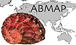 ABMAP
ABMAP