NICOBAR: (BMNH 1829,
1).
VIETNAM: Pulo Condor
(9¡ 20' N 106¡ 40' E) (MNHN no #, 1)
INDONESIA: Bali,
Nusa Dua (LACM 86-164, 1: complete). SW Java, Sukabumi, Queens Bay
(AMNH 103486, 2). Java, Batavia/Jakarta (MNHN no #, 1). Java, Drini
Beach, near Jogjakarta (DLG no #, 2). Bali (AMS
C.060942, 2).
QLD.: GBR, off
Cairns, Arlington Reef (AMNH 178752, 2). Near Gladstone (USNM 595682,
1).
NSW: Sydney (MNHN no #, 2). Gulf of Carpentaria,
Bountiful Is (AMS C.400889, 2). Gulf of Carpentaria, Forsyth Is (AMS
C.015830, 5). Gulf of Carpentaria, Mornington Is, White Cliffs & Melbidir
Bay (AMS C.014540, 7). Gulf of Carpentaria, Sweers Is (AMS C.400890,
2).
NT: Taipang/Taypang
Bay [= Trepang ?] (AMNH 114549, 1; MNHN no #, 1). Nhulunby, Gove Peninsula
(BMNH 2341, 1). Yirrkala, Arnhem Land (USNM 602298, 14). Point Charles
(ANSP 267918, 2). Allaru Is, Cobourg Peninsula
(AMS C.328741, 0, 3: complete). Off Cobourg,
Croker Isl. (BMSM 2086,1). Arnhem Land, Gove Peninsula, Yirrkala
(AMS C.073340, 20). Cobourg Peninsula, Araru Point (AMS C.400886,
1). Cobourg Peninsula, Smith Point (AMS C.078717, 1; AMS C.122878,
11). Crocodile Ids, Milingimbi (AMS C.059996, 4). Gulf of Carpentaria,
Groote Eylandt (AMS C.073313, 1; AMS C.096498, 1; AMS C.098327, 3;
AMS C.400888, 2; AMS C.403149, 1). Gulf of Carpentaria, Groote Eylandt,
Bardalumba Beach Umbakumba Mission (AMS C.403150, 2). Melville Is,
near Garden Point Catholic mission (AMS C.078654, 1; AMS C.400891,
1). New Year Is, NE of Cobourg Peninsula (AMS C.400887, 1). Nhulunbuy
town beach, Gove Peninsula (AMS C.403110, 8). Rose River mouth Mission,
SE Arnhem Land (AMS C.096534, 1).
WA: Cape Leveque
(USNM 618426, 3). King Sound (LACM A.2777, 2; AMNH 111949, 1). Broome
(LACM 45877, 5; AMNH 169622a, 1). Broome, Gantheaume Point (LACM 45979,
3; DMNH 124207, 1). Broome, Quondong (AMNH 110146, 1). Broome, Roebuck
Bay (AMNH 199647, 4; AMNH 182972, 4). Port Headland (LACM 45802, 1;
LACM A.6548, 1). Rosemary Isl. (DLG AAB 13e, 2). Nicol Bay (LACM 45887,
1). Karratha, Fourth-Mile Beach (BMSM 3370,
2). Dampier (DLG AAB 13f, 4). Dampier Archipelago (SBMNH no
#, 4). Point Samson (NHB 11 239-a, 1; NHB 11 244-a, 1). Barrow Isl.
(USNM 692029, 1). Barrow Isl., Airport Beach (USNM 691996, 4: complete).
Between Cape Dupuy and Cape Malouet (USNM 691874, 4: complete; USNM
691827, 13: complete). NE of Onslow, Montebello Isl., Trimouille Isl.
(LACM 95-66, 2). NE of Onslow, Pasage Isl., Great Sandy Isl. (LACM
95-63, 8 + 1 complete; LACM 95-64, 1 + 1 with dried body). NE of Onslow,
Weld Isl. (LACM 95-60, 2). Yanchey's [= Yanchep ?] Beach (LACM S.1114,
1). Murat, Exmouth (AMS C.328734, 3: complete). Learmouth, Exmouth
Gulf (AMS C.328735, 2: complete). S. of Exmouth townsite, Exmouth
Gulf (AMS C.328738, 3: complete), Bundegi Reef, Exmouth (AMS C.328732,
3: complete). Off Carnarvan (AMS C.328740, 2: complete). Port Gregory,
N of Geraldton (AMS C.328733, 15: complete). Off Perth (DMNH 012213,
3). Swan River (BMNH no #, 5). Shark Bay (BMNH 2341, 1). Vlaming Head
(AMNH 96444, 3). Cape Preston, Regnard Bay (SBMNH no #, 1). Cape Preston
(AMNH 220131, 1). SE of False Cape Bossut, Lagrange Bay (ANSP 233326,
1). 13
ml S of Exmouth town (AMS C.328736, 0, 4: complete). 1km N of Port
Hedland (AMS C.140183, 2). Beagle Bay (AMS C.078652, 7). Broome (AMS
C.400884, 8). Broome (AMS C.400894, 2). Broome, Cable Beach (AMS C.402492,
2). Bundegi Reef, Exmouth (AMS C.404572, 0, 1: complete). Bundegi
Reef, Exmouth (AMS C.095705, 1; AMS C.328737, 0, 3: complete). Bundegi
Reef, N side of Naval Base, Exmouth (AMS C.400878, 1, 4: complete).
Cape Leveque (AMS C.400885, 4). Cape Leveque, NE side (AMS C.071423,
1). Carnarvon (AMS C.096543, 1). Entrance Point, Broome (AMS C.138777,
3). Exmouth, beach opposite U.S. base, N of town towards Bundegi Reef
(AMS C.328739, 0, 3: complete). Exmouth Gulf (AMS C.069346, 2). Exmouth
Gulf, 17ml S of Exmouth townsite (AMS C.328738, 0, 3: complete). Exmouth
Gulf, Learmonth (AMS C.328735, 0, 2: complete). Gantheaume Point,
W of Broome (AMS C.138778, 4). Geographe Bay (AMS C.018029, 1). Monte
Bello Is (AMS C.049679, 1; AMS C.400881, 2). Ningaloo, S of North
West Cape (AMS C.400879, 1). Off Carnarvon (AMS C.328740, 0, 2: complete).
Onslow area (AMS C.400883, 5). Point Murat, Exmouth (AMS C.328734,
0, 3: complete). Point Quobba (AMS C.400877, 1). Point Quobba, N of
Carnarvon (AMS C.403124, 1). Point Samson, near Port Hedland (AMS
C.073295, 3). Port Gregory, N of Geraldton (AMS C.328733, 0, 11: complete).
Port Hedland (AMS C.078653, 1; AMS C.096495, 1; AMS C.096533, 2; AMS
C.403311, 2). Quondong Pt, N of Broome (AMS C.402493, 4). Roebourne
(AMS C.402491, 2). Shark Bay (AMS C.073338, 6). Shark Bay, near Denham
(AMS C.400880, 1). South Cowaramup (AMS C.402380, 1).
LITERATURE, LOCALITIES:
Java, Karang Hawoe; Bali, beach between Boegboeg and Boeitan (Adam
& Leloup, 1938). Sunda Straits; Prinz Eiland (= P. Panaitan); S coast
of Java, Wynkoops Bay (= Pelabuhanratu, Teluk) (Talmadge, 1963). Ningaloo
Marine Park (Wilson, 1993).
LITERATURE, RANGE:
W and NW Australia; Indonesia (Talmdge, 1963). Shark Bay - NT (Wilson,
1993; Wells & Bryce, 1985). Bali, Lesser Sunda Isl. (Dharma, 1988).
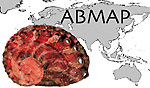 ABMAP
ABMAP